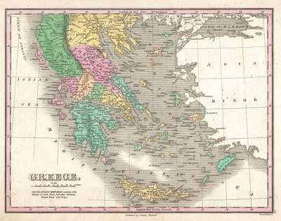
Griechenland und seine Regionen 1827
Bitte klicken Sie auf das Bild, um zu einer größeren Ansicht zu gelangen.
Anthony Finley (1790–1840), Griechenland, Karte, undatiert, in: Finley, Anthony: A New General Altas, Comprising a Complete Set of Maps, representing the Grand Divisions of the Globe, Together with the several Empires, Kingdoms and States in the World; Compiled from the Best Authorities, and corrected by the Most Recent Discoveries, Philadelphia, 1827; Bildquelle: Geographicus Rare Antique Maps / Wikimedia Commons, http://commons.wikimedia.org/wiki/File:1827_Finely_Map_of_Greece_-_Geographicus_-_Greece-finley-1827.jpg, gemeinfrei.
