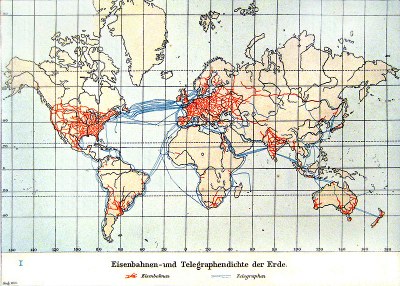
Global railway and telegraph concentration 1901

The 19th century was marked by an increased mobility as well as an accelerating global exchange of information and goods. In this development railway and telegraphy networks played a crucial role, even though mostly Western countries and some of their colonies benefited from it. Especially the railway technology required transnational standardisation regarding the track width, which led to the establishment of a rail network that connected all railway stations in Eurasia by the year 1910 (caption by the editorial team).
Cartographic representation of the railway and telegraph density of the earth; source: Andree, Richard / Scobel, Albert (eds.): Allgemeiner Handatlas in 126 Haupt- und 139 Nebenkarten nebst vollständigem alphabetischem Namensverzeichnis, 4. ed., Bielefeld 1901, p. 17 (Kolonial- und Weltverkehrskarte), Wikimedia commons, http://commons.wikimedia.org/wiki/File:Eisenbahnen-_und_Telegraphendichte_der_Erde_um_1900.jpg?uselang=de, public domain.