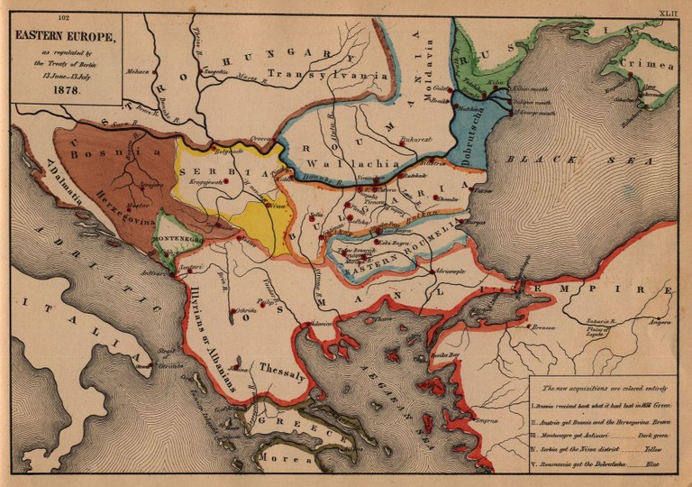
Die Länder Südosteuropas nach dem Berliner Kongress (1878)

Die Karte zeigt die Neuaufteilung Südosteuropas als Resultat des Berliner Kongresses im Jahr 1878.
Eastern Europe as regulated by the Treaty of Berlin 13 June–13 July 1878, Karte, 1884, unbekannter Ersteller; Bildquelle: Labberton, Robert H: An Historical Atlas, 1884. Digitalisat: University of Texas at Austin, http://www.lib.utexas.edu/maps/historical/eastern_europe1878.jpg. Courtesy of the University of Texas Libraries, The University of Texas at Austin.